The Extreme Heat Wave of 2026
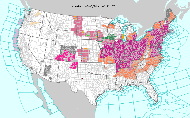
On July 3rd 2026, millions of Americans were either under an extreme heat warning, or heat advisory through the 4th, making for a steamy celebration this Independence Day (National Weather Service).
The Eastern half of the United States sweltered under one of the deadliest heat waves in recent years as a “heat dome” took control across the Southern Mid-Atlantic. Many locations achieved temperature readings well into the triple digits as this stretch of heat and humidity baked the Midwest, Ohio Valley and the Eastern Seaboard through the Independence Day weekend.
Protecting yourself from the heat is crucial and millions of Americans faced this deadly threat. In fact, the number-one killer among all weather hazards is heat! With fireworks shows, barbecues, and other outdoor activities scheduled, here are some great tips to keep cool. Staying indoors is a very easy way to limit exposure to the humid weather outside. If you’re planning on doing any strenuous exercise, limit intense outdoor activity to the early morning and evening hours. Stay hydrated by drinking plenty of fluids and using cooling stations if outdoors during future heat waves.
Additionally, humans were not the only ones at risk during this extreme heat wave. Pet owners had to be especially careful when walking dogs and cats because asphalt temperatures are much higher than those of grass. Protecting your furry friends with the proper paw protection to keep their paws safe is a requirement when walking on sidewalks and in roads. Also, your pets need hydration too, so be sure to bring a water bottle for your dog or cat, just like my sister is doing with her dog, Baxter.
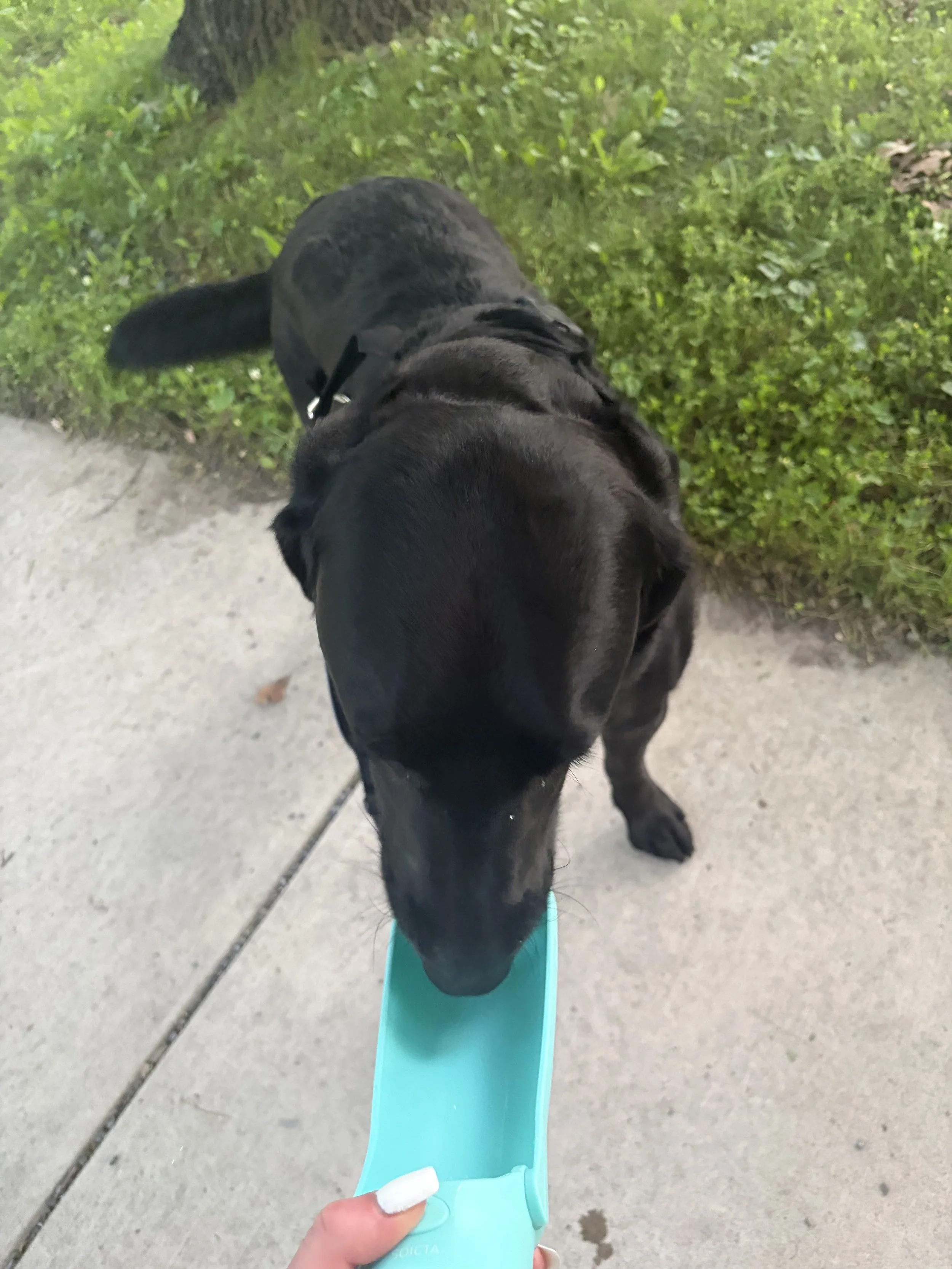
My sister providing her dog Baxter with plentiful hydration during an early morning walk in State College, PA (Credit: Carly Tomfohrde)
The number of people who were affected by this extreme heat was vast. Heat alerts extended from the Kansas/Missouri border, all the way to Maine, a total of about 1500 miles! Temperatures between 90 - 105 degrees were anticipated in locations under a “heat advisory” and “extreme heat warning”. Additionally, the heat index, which accounts for air temperature and relative humidity, was forecasted to reach a staggering 95-115 degrees. On July 2nd 2026, daily record high temperatures at climate sites in the Mid-Atlantic were broken in locations such as Wilmington, DE, tied in Trenton, NJ, and Reading, PA. Into the Northeast, New York City made history by reaching triple digits for the first time in a decade. The last time the Big Apple recorded 100 degrees was back on July 18, 2012. Boston notched a daily high-temperature record that stood for six decades with a 101-degree day. On July 4, the heat backed off slightly but still remained toasty. In the Mid-Atlantic, the records continued to mount. In Philadelphia, Independence Day marked the third straight day recording a temperature over 100 degrees, the first time in recorded history. At nearby Atlantic City International Airport (KACY), the mercury unofficially tied an all-time record, reaching a whopping 106 degrees! Here in Central NJ, my Tempest weather station recorded highs of 102, 102 and 100 on July 2nd, 3rd and 4th respectively. Sadly, in New Jersey, at least 29 heat-related deaths were reported so far.
Additionally, during the holiday weekend, severe weather and flooding broke out across the Mid-Atlantic and Northeast. Usually at the tail end of a heatwave, all the instability built up by the atmosphere results in thunderstorms and severe weather, with this particular heat wave going out “with a bang.” On the 3rd and 4th, a swath of storms ripped through the Northeast and Mid-Atlantic leaving millions in the dark.
Radar Imagery of the July 3rd Storms that impacted New Jersey between approximately 6PM-12 AM. (MRMS Viewer)
Radar Imagery of the July 4th, 2026 Storms that impacted Connecticut, the Hudson Valley, Long Island, Pennsylvania and New Jersey between approximately 6PM-12AM (MRMS Viewer)
On July 5th, the flash flood threat arrived, delivering a widespread 1-3” across much of the state. Locations along the Jersey Shore even received up to half a foot of rainfall, resulting in widespread street closures and water rescues. In Oakhurst, a BJ’s Wholesale collapsed due to the weight of the water on a roof.
The full list of rainfall reports across the region can be viewed here: 48 Hour NWS Mount Holly Rainfall Totals as of July 7th. In a year when extreme cold, a blizzard, severe weather, extreme heat, and intense flash flooding have affected the Northeast, it's hard to predict which hazardous weather phenomenon will next impact the region.
